the Creative Commons Attribution 4.0 License.
the Creative Commons Attribution 4.0 License.
 | 16 Sep 2026
A remote sensing–based approach to the regionalization of socioeconomic indicators in an agricultural headwater catchment in Northern Benin
Yaovi Aymar Bossa

Adjo Brigitte Bossa
Yacouba Yira
Kpade Ozias Laurentin Hounkpatin
Octave Djangni
Jean Hounkpè
Hélyette Arielle Odoumbourou
Ernest Amoussou
Related authors
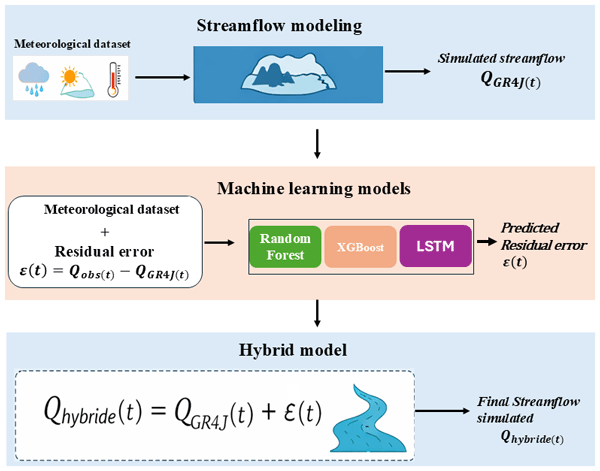
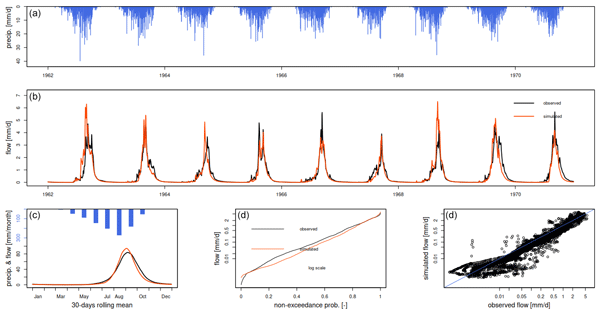
This study aims to improve river flow prediction in a region where hydrological data are limited, which is essential for water management and flood preparedness. We combined a traditional rainfall–runoff model with data-driven learning methods to correct systematic simulation errors. Results show that the combined approach predicts river flow more accurately than the traditional model alone. These findings highlight a practical way to improve water resource planning in data-limited regions.

This study aims to improve river flow prediction in a region where hydrological data are limited, which is essential for water management and flood preparedness. We combined a traditional rainfall–runoff model with data-driven learning methods to correct systematic simulation errors. Results show that the combined approach predicts river flow more accurately than the traditional model alone. These findings highlight a practical way to improve water resource planning in data-limited regions.