Land subsidence monitoring using distributed fiber optic sensing with Brillouin scattering in coastal and deltaic regions
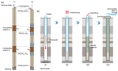
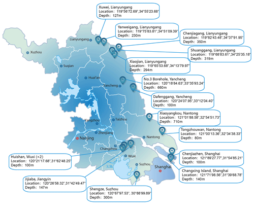
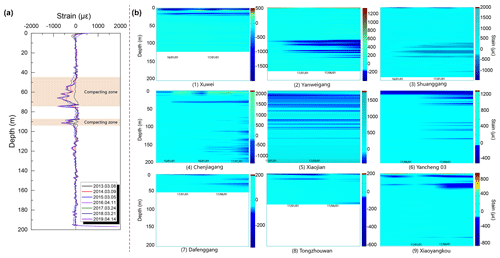
Excessive withdrawal of groundwater in coastal and deltaic regions is one of the main reasons which induce land subsidence in these areas. Land surface displacement monitoring with conventional methods is not able to pinpoint subsurface compacting, which is very challenging. Instead of groups of extensometers, we apply distributed fiber optic sensing (DFOS) with Brillouin scattering in vertical boreholes to identify the deformation distribution along the entire borehole with meter-scale spatial resolution. We here present 10 boreholes with depths range from 100 to 600 m with DFOS monitoring along the east coastal line of Jiangsu and Shanghai since 2015, and 1 borehole of 300 m in depth in Yangtze River delta since 2012. The results provide clear images on the deformation distribution along entire boreholes, by identifying the main contributors to the subsidence and the deformation evolutionary processes, with stable long-term monitoring performance. Hence, we demonstrate that DFOS can open window into subsurface deformation and could be important complementary to conventional methods to understand the land subsidence processes in coastal and deltaic regions.


