| 18 Apr 2024
Effects of the latest drought on the alluvial aquifer of a semiarid region in northeastern Brazil
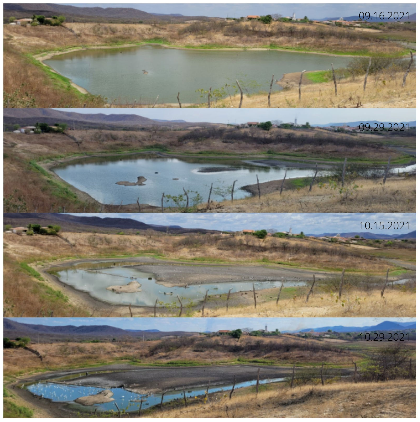
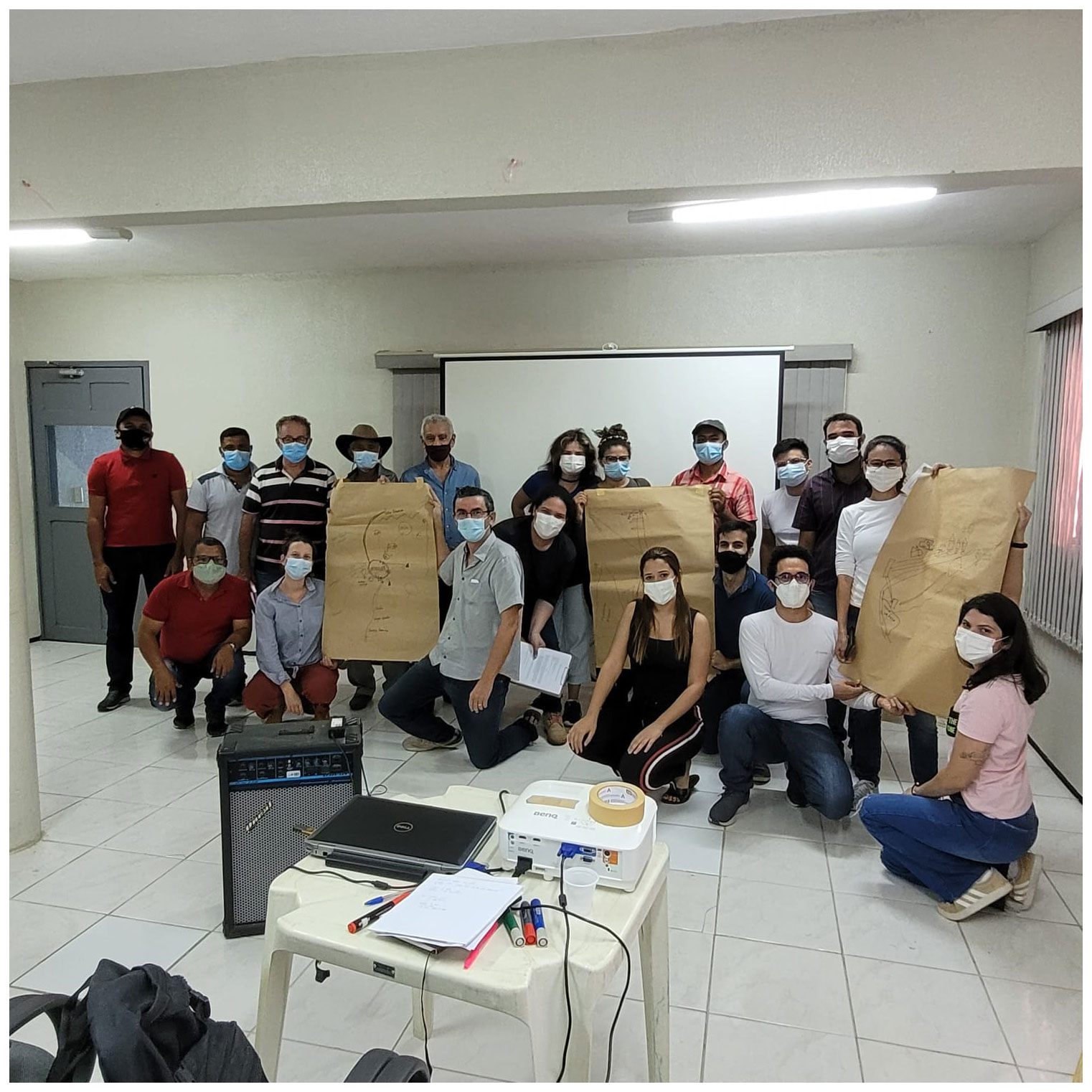
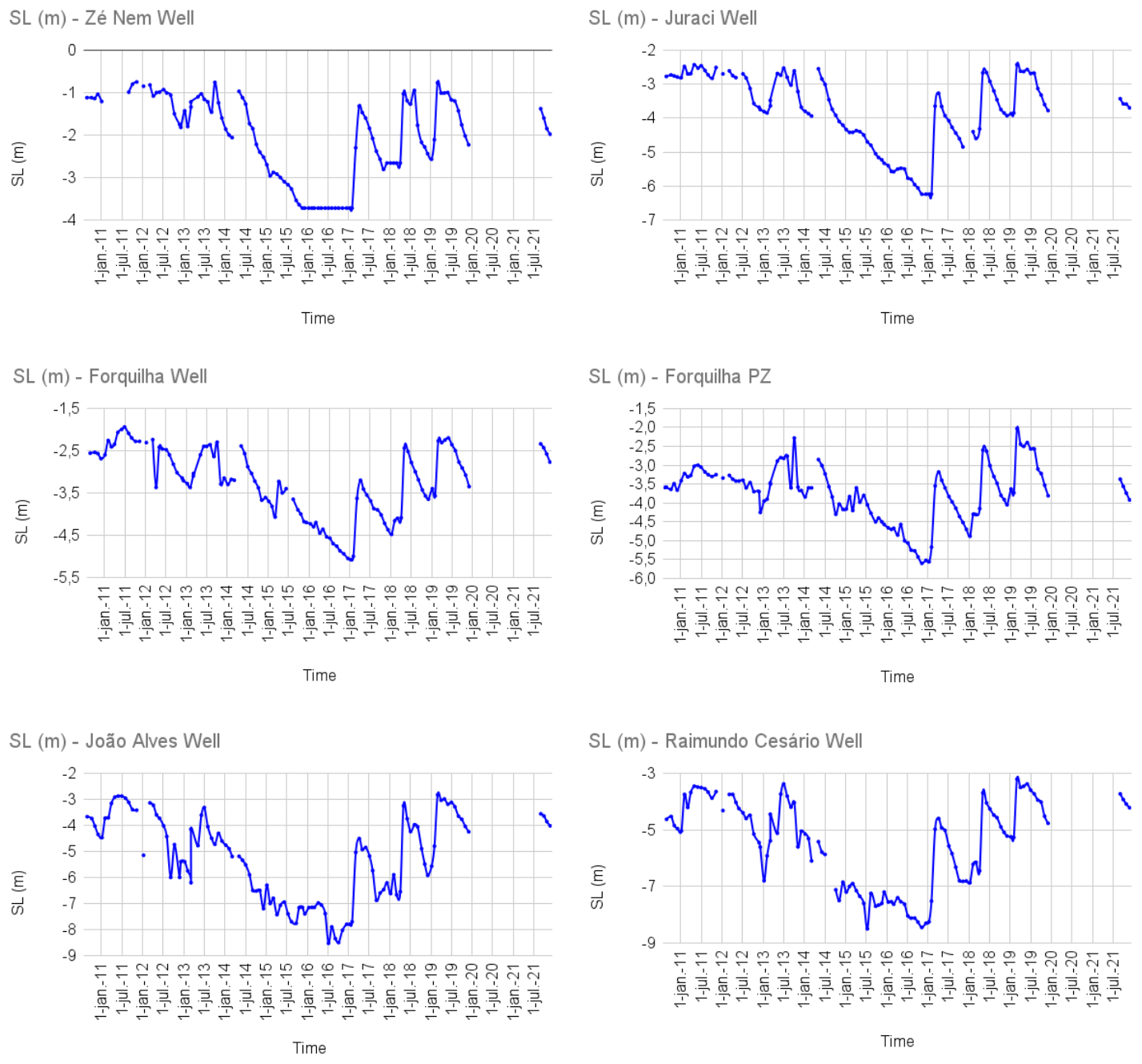
Climate change has modified global and local water cycle patterns inducing more intense and severe drought events. In the Ceará state (Northeast Brazil), a semiarid region very vulnerable to droughts, groundwater acts as a strategic reserve to ensure water security for small rural communities. Well drilling jointly with the building of dams and cisterns are the main policy performed by the public authority to cope with the droughts. This study performed a preliminary qualitative analysis to investigate the effects of dam building in the piezometric level of an alluvial aquifer in the Ceará state during the most recent drought (2012–2016). The micro-basins of the Algodão and Forquilha creek were selected as study area, in which the alluvial aquifer has been monitored by Funceme since 2010. The alluvial aquifer was extensively exploited for local agriculture before the drought (2012–2016) due to public policies of well drilling (2001–2002). During the most recent drought, the construction of new dams, coupled with reduced rainfall, compromised the recharge of the alluvial aquifer. We evaluate these effects through the groundwater level. The results revealed a continuous drawdown of groundwater in the monitored wells. Since 2017 the piezometric level started to rise, however, the graphs reveal a different behavior of the piezometric levels monitored after the latest drought, with sudden changes between the periods of recharge and drawdown of the alluvial aquifer. Field diagnostics with local stakeholders revealed how the latest drought changed the dynamics of the activities developed by the rural communities. Before the drought the aquifer supplied the local agriculture. The drought has affected the recharge of the alluvial aquifer and compromised local agriculture. Local stakeholders have adapted, and agriculture has been replaced by livestock. The heterogeneity of this environment and of its water users requires efficient management policies adapted for the local physical and socioeconomic conditions to avoid overexploitation and maintain the recharge of the alluvial aquifer. These policies at the local scale can be the identification of local actors who are willing to develop their own management of surface and groundwater resources.