| 22 Apr 2020
Hydraulic behavior of subsidence-induced surface discontinuities in the hydrogeology of the Aguascalientes valley
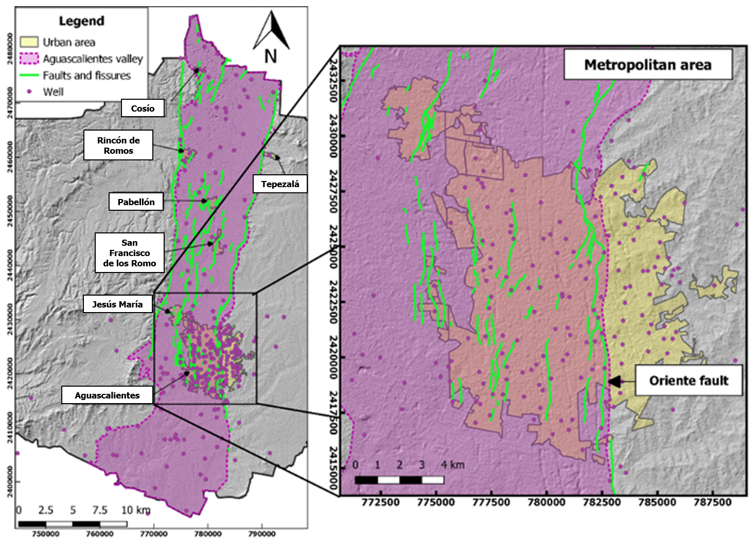
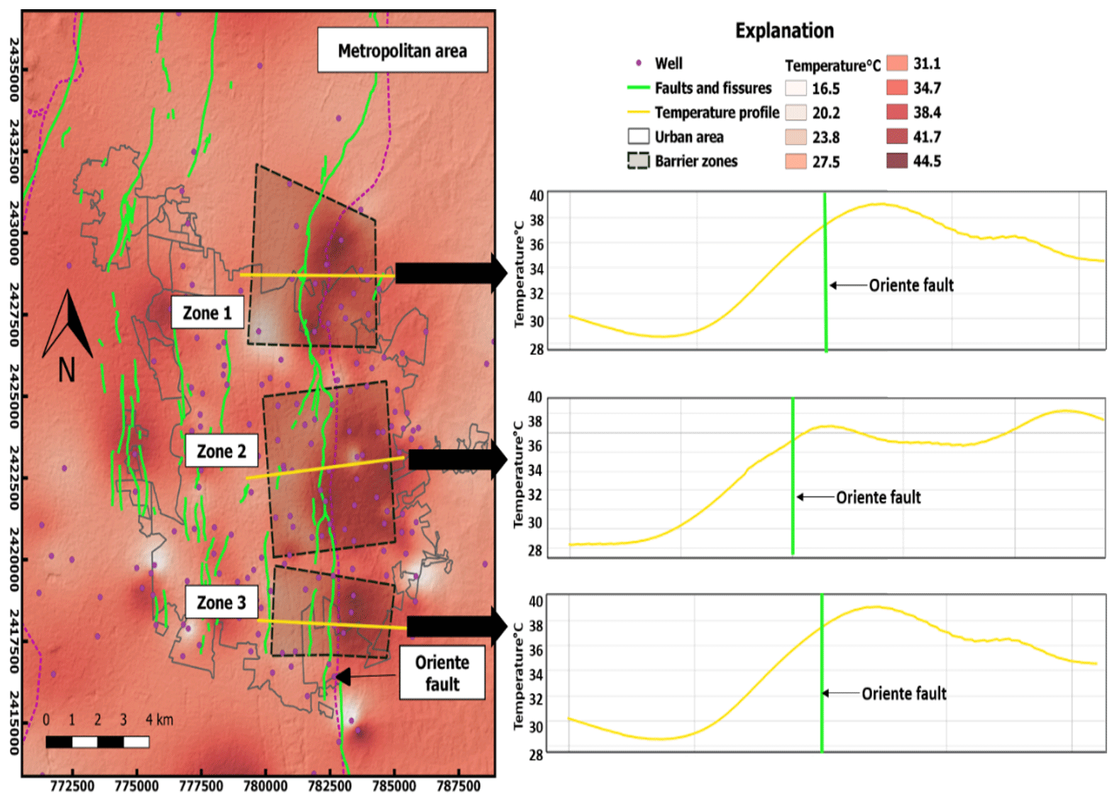
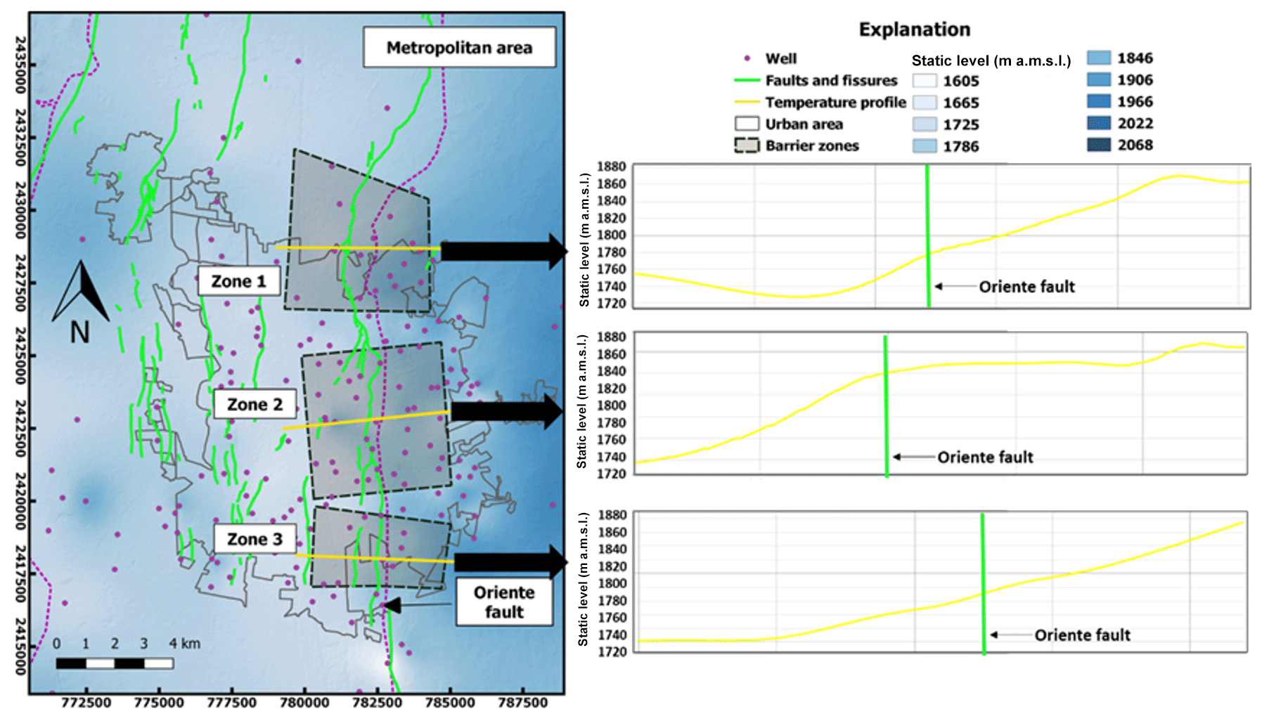
The impact of faults and fissures (discontinuities) on the groundwater flow has become important in several parts of the world because the heterogeneous and anisotropic distribution of permeability in fault zones is difficult to characterize. Based on this, we propose an analysis of patterns of parameters measured in groundwater, under the premise that the observed anomalies can be indicators of the hydraulic behavior of the flow in the direction perpendicular to the fault plane. In this context, if the discontinuities are sealed, they behave as hydraulic barriers, causing variation in the continuity of the parameters across the fault plane. Conversely, when faults are a conduit, they appear to have a small or null variation in the distribution of the parameter measurements. The impact of discontinuities in groundwater flow in a zone with a large number of faults and fissures such as that of the Aguascalientes valley is being studied using a graphical-correlation analysis with the revision of 230 wells, through the measurement of parameters such as temperature and static levels across discontinuities, in order to determine the hydraulic behavior of the faults. This investigation considered values over 4 ∘C for geothermal variations and 10 m for hydraulic-head changes to define fault behavior. Results show three zones through mapping analysis, where the fault presents barrier behavior and where the hanging block represents high values; these anomalies are much higher than the average across the valley and indicate the propensity for the fault to restrict horizontal flow. In conclusion, the Oriente fault presents complex behavior of a barrier–conduct system along the fault. This analysis gives a robust way to describe fault behavior without referring to elaborate and invasive hydrological investigations.