Greenhouse gas emissions and surface water management
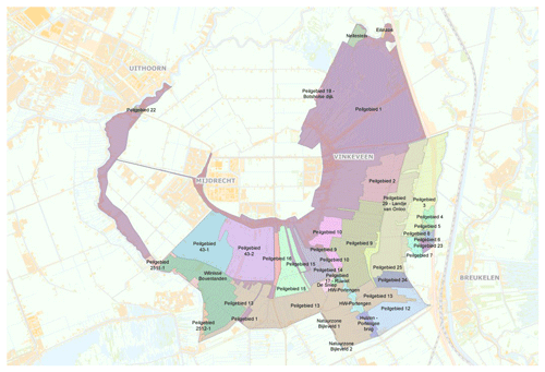
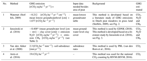
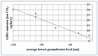
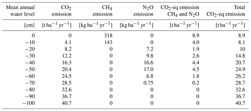
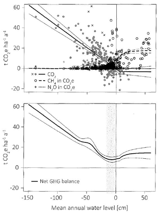
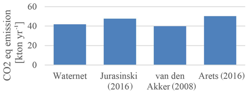
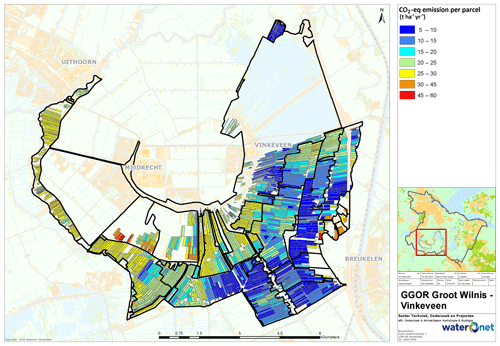
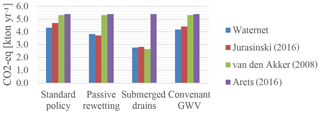
Soil subsidence is one of the major issues in the management area of the water authority Amstel, Gooi and Vecht, including emissions of greenhouse gases. This paper describes four different methods to calculate these emissions in agricultural peat meadows, based on (1) the mean lowest groundwater level, (2) the mean groundwater level, (3) the subsidence rates and (4) general numbers. The emissions were calculated in two polders (about 2600 ha peat meadow), these were comparable for all methods, ranging from 42 up to 50 kton CO2-eq yr−1 (based on data of 2015), which is about 14.5 up to 19 t CO2-eq ha−1 yr−1. Besides, the greenhouse gas emissions were compared for different policy scenario's in one polder subunit (283 ha): (1) standard policy (lowering surface water level at the same rate as soil subsidence taking place), (2) passive rewetting (surface water level fixation), (3) subsurface irrigation by submerged drains, and (4) a maximum surface water level decrease of 6 mm yr−1. Comparing the four policy scenario's in one polder subunit, greenhouse gas emissions were lowest in case of subsurface irrigation, decreasing greenhouse gas emissions by about 35 %–50 % in this polder compared to standard policy, meaning a decrease of about 5.5–9.3 t CO2-eq ha−1 yr−1. This represents a value of about 550–930 EUR ha−1 yr−1 (at a price of EUR 100 per ton CO2-eq). The scenario passive rewetting leads to a decrease of about 12 %–21 %, or 2–3 t CO2-eq ha−1 yr−1 compared to standard policy. The estimation of the decrease in GHG emissions depends on the assumptions made. In this study it was assumed that subsurface irrigation halves soil subsidence. The water board will use the described procedures to estimate greenhouse gas emissions in the future to support water level management in areas with peat soils.


